YellowScan Fly & Drive
Fly when you can, drive when you must.Fly & Drive is a combo that can do mobile mapping & aerial survey using the same LiDAR (Surveyor or Surveyor Ultra). The setup consists of a car pod, adaptable bracket and GNSS antenna.
See More
Mapper +
The YellowScan Mapper+ is a compact LiDAR system designed for high-density surveying, offering three echoes for precise data collection. It is built with Applanix and Livox technology, ensuring accurate performance with a system precision of 3.5 cm and an accuracy of 4 cm. The system weighs 1.1 kg excluding the battery and operates effectively at altitudes of 100 meters (330 feet). It is also compatible with an RGB camera module for enhanced imaging.
See More
Voyager
The YellowScan Voyager is an advanced LiDAR solution designed for large-scale, high-precision mapping in challenging environments. It supports long-range operations and is ideal for applications such as forestry, infrastructure inspection, and surveying. Featuring cutting-edge laser sensors, the system provides real-time processing and exceptional accuracy. It is compatible with a range of UAV platforms, ensuring seamless integration and robust, reliable performance for professional-grade results.
See More
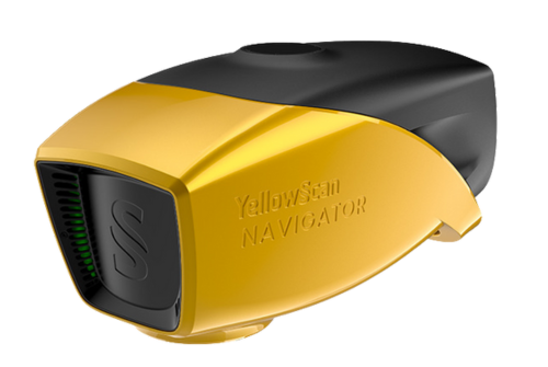
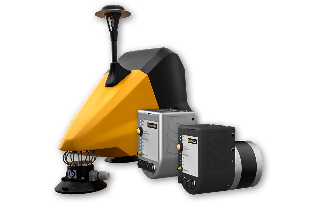
Navigator
The YellowScan Bathymetric LiDAR is a lightweight and precise system for mapping both underwater and ground terrains. It integrates seamlessly with UAV platforms and includes software for automatic water classification and surface detection. The system features a laser scanner, IMU solution, and an embedded RGB camera, making it ideal for detailed environmental mapping.
See More
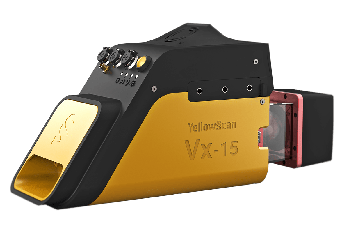
Vx15 series
YellowScan designed an all-integrated, easy-to-use LiDAR system that includes the renowned Riegl laser scanner and Applanix UAV IMU APX-15. YellowScan Vx15 is an excellent solution for your high flight UAV projects with short-time data processing needs. It is ideally sized for all types of UAVs weighing 2.6kg including battery.
See More
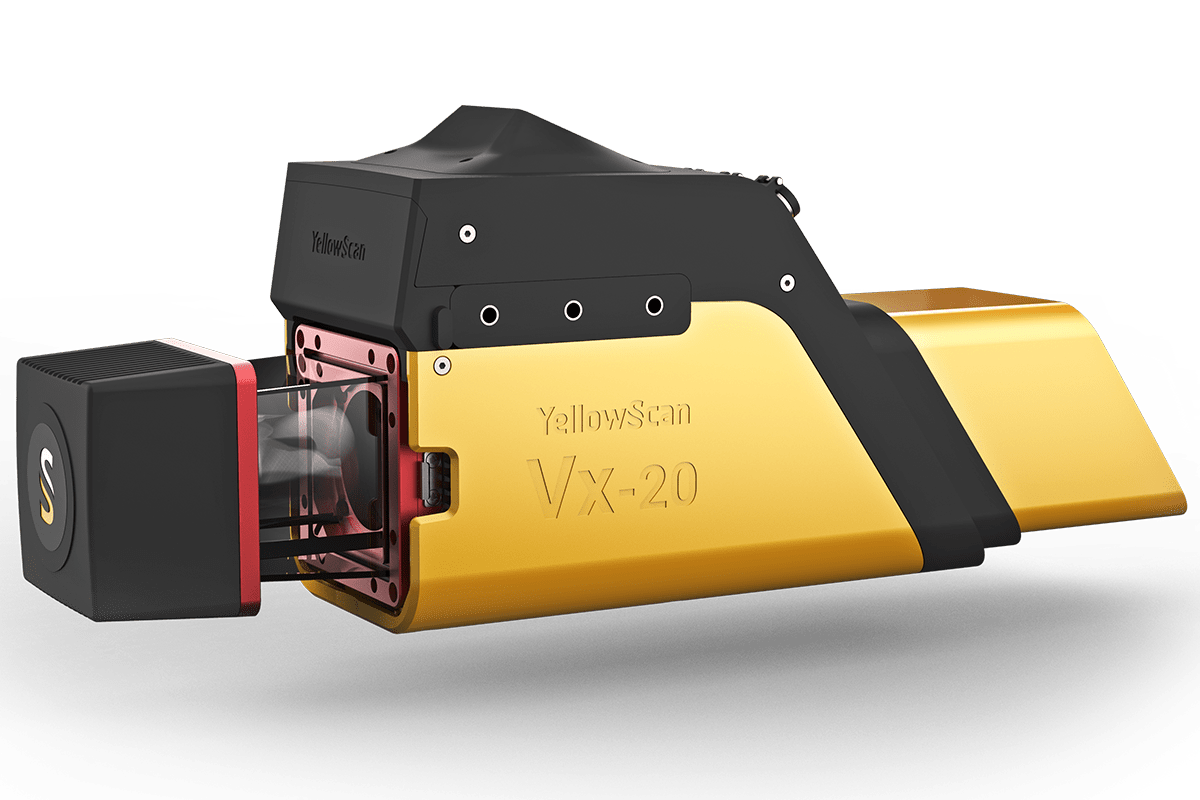
Vx20 Series
YellowScan Vx20 is the most accurate fully integrated system from YellowScan’s product range. It can fly up to 100m while maintaining accuracy of 5cm with precision of 1cm throughout the point cloud with 90° FOV .The Vx20 series is ideally suited for applications that requires sharp and accurate descriptions.
See More
YellowScan Surveyor
YellowScan Surveyor provides a 360° Field of View with its Velodyne VLP-16 laser scanner. It is the right solution for horizontal, vertical mapping and mobile mapping, when associated to Fly&Drive.
See More
YellowScan Surveyor Ultra
YellowScan Surveyor Ultra LiDAR system is suited for high speed UAV (VTOL fixed-wing or helicopter) and long-range needs due to its high-density specifications. With the 360° Field of View of the Velodyne VLP-32 laser scanner, YellowScan Surveyor Ultra is matching vertical mapping and mobile mapping needs when combined with Fly&Drive.
See More


.png)
.png)